New Underwater Map of Ethiopia’s Blue Nile Reservoir Clears the Way for Commercial Fishing and Boat Transport
Arba Minch University hands over the country’s first bathymetric survey of Africa’s largest reservoir, giving engineers, fisheries authorities, and transport planners data they have never had before.
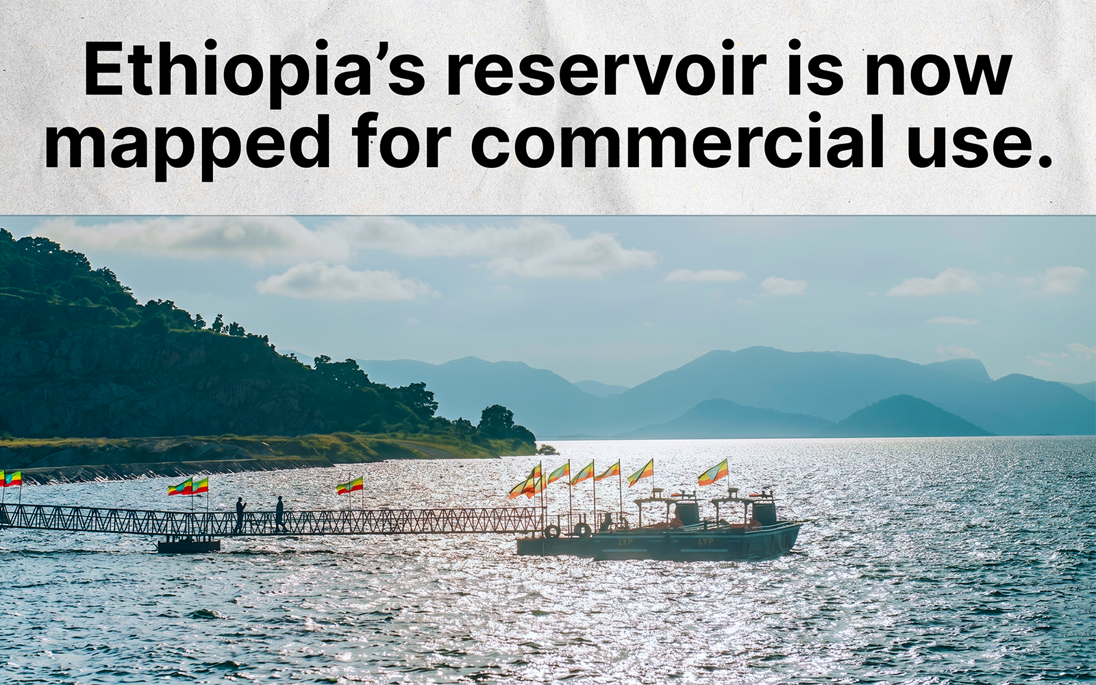
Ethiopia has completed the first-ever underwater map of Nigat Lake — the massive reservoir created by the Grand Ethiopian Renaissance Dam — and formally handed it over to the relevant authorities. The survey was conducted by Arba Minch University, using Ethiopian researchers and equipment, without foreign contractors. It is the first time the country has produced a precise, three-dimensional chart of the lake’s floor.
Nigat Lake — its name meaning “Dawn” in Amharic, officially designated in 2025 as the dam reached full retention — is the reservoir created when the Blue Nile was impounded by GERD in western Ethiopia. It holds more than 70 billion cubic metres of water. To put that in perspective: Lake Tana, Ethiopia’s largest natural lake and the source of the Blue Nile, holds roughly 29 billion cubic metres — meaning Nigat Lake holds more than twice as much. Globally, it is comparable in size to Lake Nasser, the reservoir behind Egypt’s Aswan High Dam, and larger than Lake Volta in Ghana, which was previously the largest man-made reservoir in Africa. The impoundment began in July 2020 and was completed in October 2024, flooding a valley system and forming more than 70 islands.
Bathymetry is the measurement of underwater depth and terrain — the equivalent of topographic mapping, applied to a lakebed rather than dry land. Without it, the floor of Nigat Lake was completely unknown: no verified data existed on where the shallow shelves are, where the deepest channels run, or how the ancient riverbed of the Blue Nile sits beneath hundreds of metres of water. That gap had direct operational consequences. Commercial vessels cannot safely navigate a lake when its underwater topography is uncharted; fish-farming operations cannot be sited without knowing depth and water-column conditions; and dam engineers cannot measure sediment accumulation — the primary long-term threat to any hydroelectric facility — without a baseline record of where the floor currently sits. The Arba Minch University survey is that baseline.
The choice of institution is notable. Arba Minch University was founded on the campus of the Arba Minch Water Technology Institute, established in 1986 specifically to address Ethiopia’s water-resource capacity gap. It now runs 74 undergraduate and 115 graduate programmes, with a student body of 39,000, and houses one of the continent’s most specialised water-engineering faculties. Major dam infrastructure across Africa has historically depended on foreign consultancies for technical studies of this kind — European engineering firms or international hydrological agencies that complete the work and leave, with little transfer of expertise. A domestic university producing this survey means the methodology, the instruments, the trained researchers, and the raw data all remain in Ethiopia.
The most immediate application of the map is maritime navigation. The Ethiopian government has signalled plans to establish commercial boat transport across Nigat Lake, which stretches from the dam wall upstream into the highlands for hundreds of kilometres. Before this survey, no vessel could safely operate on those waters: the submerged terrain of a former river gorge contains ridges, shallow plateaus, and ancient riverbanks at unpredictable depths. The bathymetric chart provides the foundation for navigation routes, maritime safety regulations, and the port-siting decisions that any inland water transport system requires before it can be licensed, insured, or operated commercially.
For fisheries development, the depth map is equally foundational. Water temperature, oxygen saturation, and the distribution of aquatic life vary with depth — a reservoir this size will contain multiple distinct ecological zones depending on how the lakebed is contoured. Identifying those zones is the prerequisite for any structured aquaculture investment: where to anchor fish-farming enclosures, which species are viable at which depths, and where natural fish populations are likely to concentrate. Ethiopia has a protein-access challenge for a population of over 120 million people; a well-managed commercial fishery on Africa’s newest and largest reservoir is a concrete contribution to closing that gap, and this survey is the document on which that development plan must be built.
The deepest long-term value of the survey, however, is in sediment management. The Blue Nile carries one of the highest sediment loads of any river system in the world — the Ethiopian highlands shed enormous quantities of topsoil during the rainy season, and that material washes downstream into the reservoir. Over time, sediment settles on the lakebed and fills the available storage volume from the bottom up, permanently reducing the dam’s water-holding capacity and, therefore, its electricity output. The International Hydropower Association identifies siltation as a primary long-term risk to GERD specifically. GERD represents an investment of approximately 4.8 billion US dollars, built largely through Ethiopian state financing — by some estimates, financed in part through a public bond programme to which ordinary Ethiopian citizens contributed. Without a baseline measurement of the current lakebed position, engineers cannot calculate how fast sediment is accumulating, cannot determine when dredging or watershed interventions are needed, and cannot forecast how many decades the dam will operate at full capacity before its storage volume is compromised. The Arba Minch survey establishes that baseline. Future surveys, repeated at defined intervals, will produce the year-on-year sedimentation rate that makes long-range maintenance planning possible.
Tourism adds a further economic dimension. Nigat Lake’s more than 70 islands — formed from hilltops that remained above the flood line — are a geographic feature with no precedent in the Horn of Africa. Water-based recreation, resort development, and leisure boating on an inland sea of this scale represent an industry that did not exist in this region a decade ago. Any international investor, insurance underwriter, or tour operator considering the opportunity needs verified navigation data before committing capital. The bathymetric map, in that context, is a business-enabling document as much as a scientific one.
The completed handover covers the first phase of the survey — the primary basin of the reservoir. A lake of Nigat’s scale cannot be fully charted in a single campaign; the upper reaches and secondary arms of the former river valley require additional survey phases, which Arba Minch University is expected to continue. Each phase extends the coverage of the chart and deepens the baseline record available to engineers and planners.
What the university has delivered is, technically, a dataset: depth measurements, contour lines, underwater terrain profiles. In practice, it is the document that makes the next decade of decisions possible — where boats travel, where nets go in the water, how quickly the dam is silting up, and whether the 4.8-billion-dollar facility at the centre of Ethiopia’s energy strategy will still be operating at full capacity in fifty years. That document now exists, it was produced by Ethiopians, and it is in Ethiopian hands.